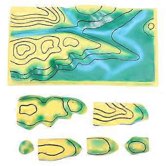
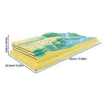
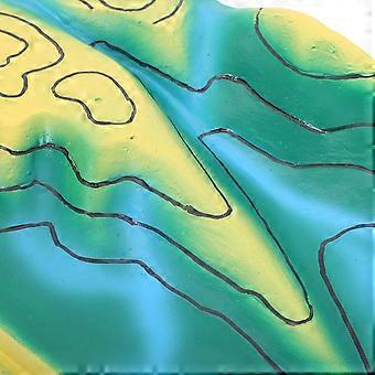
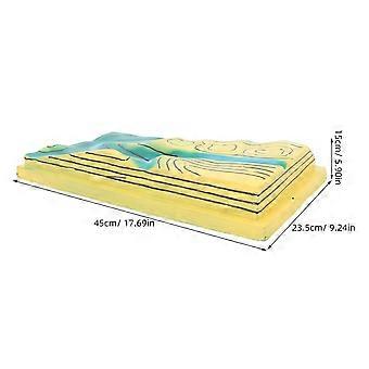

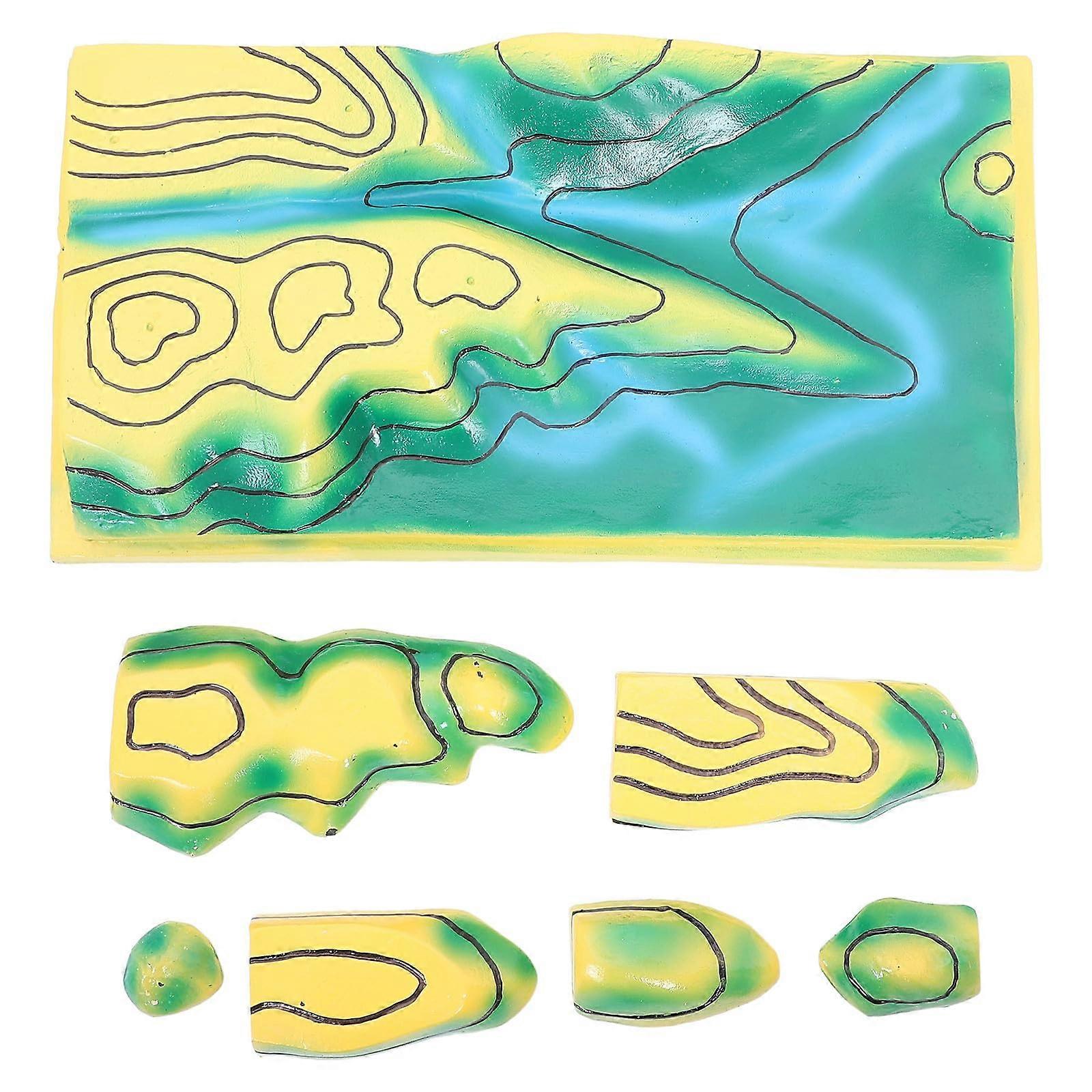
Topographic Map Model with Realistic Terrain Visualization for Classroom 3D Geography Teaching Tool
- 브랜드: Unbranded
Topographic Map Model with Realistic Terrain Visualization for Classroom 3D Geography Teaching Tool
- 브랜드: Unbranded
₩190,690
할인 ₩92,200 (32%)
권장소매가
14일 반품 정책
₩190,690
할인 ₩92,200 (32%)
권장소매가
14일 반품 정책
결제 방법:
설명
Topographic Map Model with Realistic Terrain Visualization for Classroom 3D Geography Teaching Tool
- 브랜드: Unbranded
- 카테고리: 과학/탐구 세트
- Fruugo ID: 471325941-986441052
- EAN: 6273452083448
제품 안전 정보
아래에 설명된 이 제품과 관련된 제품 안전 정보를 참조하십시오.
以下の情報は、この製品を販売する独立したサードパーティ小売業者によって提供されています。
제품 안전 라벨

- Please use this product under adult supervision; keep away from fire
- high temperature and sharp objects to prevent product damage or safety hazards; if the product is damaged
- deformed or malfunctions
- stop using it immediately and dispose of it properly.
배달
7일 이내에 발송됨
-
STANDARD: 무료 - 배달 사이 수 05 8월 2026–수 26 8월 2026 - 무료
중국에서 발송.
보고
당사는 귀하께서 주문하신 제품이 주문 명세에 따라 빠짐없이 배송되도록 온 힘을 기울이고 있습니다. 다만, 주문하신 것과 다른 상품이 배송되거나 빠진 상품이 있는 경우, 또는 주문 내용에 만족할 수 없는 다른 이유가 있는 경우에는 주문 전체나 주문에 포함된 일부 제품을 반품하시고 해당 상품에 대해 전액 환불받으실 수 있습니다.
製品コンプライアンスの詳細
以下に概説されているこの製品に固有のコンプライアンス情報を参照してください。
以下の情報は、この製品を販売する独立したサードパーティ小売業者によって提供されています。
제조사:
다음 정보는 Fruugo에서 판매되는 관련 상품의 제조사 연락처입니다.
- Wuhan Zigeng Trading Co., Ltd.
- Wuhan Zigeng Trading Co., Ltd.
- Shuangfeng Village, Building 6, No 4, Room 4157
- Wuhan
- CN
- 430108
- [email protected]
- 8615004618538
EU 내 책임자:
다음 정보는 EU 내 책임자 연락처입니다. 책임자는 유럽 연합에서 판매되는 관련 상품에 대한 준수 의무에 책임을 지는 EU에 기반을 둔 지정 경제 주체를 말합니다.
- IBERTRUST GLOBAL SOCIEDAD LIMITADA
- IBERTRUST GLOBAL SOCIEDAD LIMITADA
- C/ PABLO IGLESIAS 1A ENTRES
- CASTELLON DE LA PLANA
- Spain
- ES
- 12003
- [email protected]
- 34611904867