설명
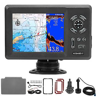
Marine Plotter,7in Marine Plotter Built Boat Navigation Positioner Marine GPS Locator Finest Materials
Features
1、7in LCD Display: 7in GPS marine plotter (color LCD 800x600), clear display, easy to read, with IP66 intrusion protection, suitable for harsh marine environments. 2、Compatible Charts: The GPS plotter is compatible with for K‑Chart 2.0, for K‑Chart 3.0, for C‑Map Max and for Navionics +. More convenient for you to use. 3、Built in Fish Finder (Transducer Needed): Using the digital fish swarm detection technology, excellent seabed identification ability, can easily identify fish and fish schools; accurately display the depth of fish schools. 4、Reverb Color: 16 colors (including background color) depending on reverb intensity. Background colors can be selected from blue, light blue, white and black. 5、Dual Frequency Transmit: Support 50 and 200 kHz (different transmit frequencies). Automatically adjust range and gain depending on usage, cruise or fish. 6、Split Screen GPS Plotter: You can adjust the split screen ratio yourself to determine which side is bigger. Save historical location, reverb enters waypoint memory.
Specification
Item Type: Marine Plotter
Material: ABS
Plotter Characteristics:
Waypoints or Icons: 12,000 user waypoints with name, symbol; 10 proximity waypoints
3 System Waypoints: MOB, Start, cursor
Routes: 30 routes waypoint up to 170 points each, plus MOB and Track Navigation or Go to Track modes. Tracks 8,000 points automatic track log; 10 saved tracks (up to 8000 track points each) lets you retrace your path in both directions
Alarms: XTE, Anchor drag, arrival, speed, voltage, proximity waypoint, Timer and AIS (CPA and TCPA) alarm
Drawing: 1000 Drawing Marks; 2000 Drawing Lines (40 points each);1000 Drawing Place Name; 8 colors for Drawing
Pallete: Normal; Daylight exposed to sunlight; Night in dark environment; NOAA paperchart colors
Tides: Built in Worldwide Tide Data
Position Format: Lat Lon
Basemap: Worldwide
External Map: Compatible with for K-Chart 2.0, for K-Chart 3.0, for C-Map Max and for Navionics+
User Data Storage: Internal backup of user settings or external storage card
Plot Interval: 5secs to 60 mins or 0.01 to 10nm
Plotting Scales: 0.001 to 700nm
Perspective View: On off (available for C-Map only)
Celestial: Sunrise, Sunset Moonrise, Moonset
Package List
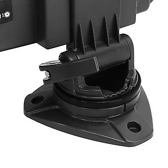
1 x Marine Plotter (with Base)
1 x Bronze Transducer (3m/9.8ft Wire)
1 x Power Cord
1 x GPS Antenna (10m/32.8ft Line)
1 x Waterproof Cover
1 x Anti Vibration Pad
4 x Double Sided Sticker
2 x Fuse
3 x Long Screws
4 x Short Screw
1 x Instruction Manual
-
Fruugo ID:
278693204-619784808
-
EAN:
9797733645950